
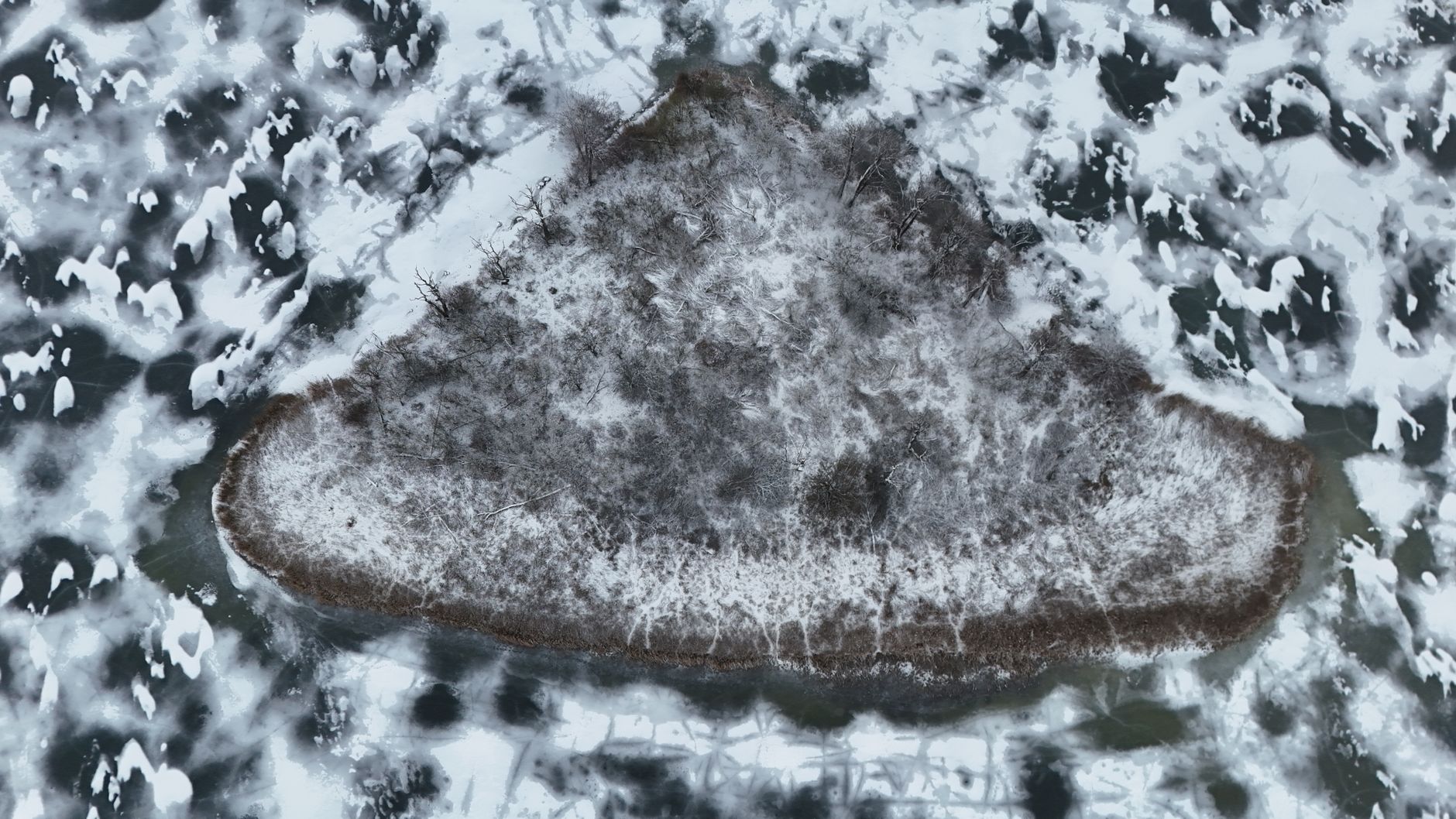
Imagem principal:Radosław Sikorski / Pexels
AI Golpe ou Realidade? A Ilha Flutuante Misteriosa Deslocou-se 19 Milhas
Como a inteligência artificial redesenha os meios digitais, verificar fenômenos naturais extraordinários tornou-se cada vez mais difícil tanto para o público quanto para observadores institucionais. Quando uma imensa massa de terra flutuante apareceu em imagens de satélite, autoridades locais inicialmente descartaram-na como uma fabricação sintética antes que rastreamentos subsequentes confirmassem seu deslocamento por dezenove milhas de água aberta. Esta investigação examina como o ceticismo tecnológico rápido colidiu com dados geográficos concretos, destacando a necessidade urgente de padrões rigorosos de verificação em uma era de manipulação digital generalizada.
The boundary between genuine environmental phenomena and advanced synthetic media has grown remarkably porous. In an environment where deepfakes and generative imagery can seamlessly fabricate landscapes, institutional authorities and independent observers alike face unprecedented challenges in determining what is real. A striking example of this friction occurred when a large floating island manifested in geographical records, prompting immediate institutional dismissal as a digital prank. However, subsequent empirical tracking proved that the physical landmass had genuinely shifted nineteen miles from its original coordinates, forcing a profound reassessment of how modern societies evaluate anomalous visual and spatial data.
O que é o fenômeno da Ilha Flutuante? Uma breve visão geral
Floating islands are rare, naturally occurring ecological formations composed of thick mats of vegetation, organic debris, and intertwined root systems that detach from shorelines and drift across bodies of water. These dynamic structures can range from small patches of reeds to massive landmasses capable of supporting trees and local fauna. Historically documented across various wetlands, lakes, and coastal estuaries globally, these formations present unique ecological systems that float independently on water tables rather than resting on the underlying solid substrate of a lakebed or ocean floor.
While natural floating islands are well-documented in scientific literature, their sudden appearance in high-resolution digital mapping and satellite databases often triggers public skepticism. Because most individuals experience these remote environments exclusively through digital screens, rare geographic occurrences are frequently met with immediate disbelief. According to reporting by Upworthy, the physical mechanics governing these floating landmasses involve changes in water levels, subterranean gas accumulation beneath the peat, and shifting wind currents that propel the massive organic rafts across vast expanses of water.
O primeiro boato: as autoridades o descartaram como uma fraude de IA.
When the anomalous landmass first registered on digital monitoring systems, local authorities and institutional gatekeepers were quick to categorize the imagery as a synthetic hoax generated by artificial intelligence. Given the proliferation of advanced image-generation tools capable of rendering hyper-realistic landscapes, officials assumed the visual data was merely another internet fabrication designed to manipulate public perception or test content moderation algorithms. This reflexive skepticism, while understandable in an era of widespread digital deception, short-circuited standard investigative protocols.
The presumption of an AI hoax relied heavily on the psychological phenomenon where extraordinary visual data is immediately rejected if it challenges established baselines of familiarity. Upworthy noted that the initial dismissal by officials prevented early coordination among environmental agencies and geologists who might have otherwise deployed physical verification teams sooner. Instead of cross-referencing telemetry data, institutional stakeholders relied on intuitive assumptions about the capabilities of generative artificial intelligence, illustrating a dangerous vulnerability where legitimate scientific discoveries are sidelined under the blanket assumption of digital forgery.
Satellite Data Reveals the Island Moved 19 Miles—Here’s the Evidence
Tracking the Displacement Through Orbital Imagery
The definitive turning point in the controversy arrived when independent analysts and institutional researchers pulled historical and real-time satellite telemetry to track the disputed coordinates over an extended timeframe. By comparing multi-spectral orbital imagery captured across consecutive weeks, experts established an undeniable chain of physical evidence. The imagery confirmed that the organic landmass was not a static digital artifact, nor a localized rendering error within mapping software, but a physical entity undergoing continuous, measurable displacement.
Quantifying the Nineteen-Mile Journey
Empirical calculations derived from orbital positioning systems revealed that the massive floating structure had traversed a total distance of nineteen miles from its original anchoring point. Upworthy reported that this significant journey was corroborated by recurring satellite passes, surface-level weather patterns, and current telemetry that mapped the precise vector of the island’s movement. This accumulation of hard geospatial data effectively dismantled the narrative that the phenomenon was an artificial intelligence hoax, replacing speculation with verifiable physical tracking.
How AI Systems Might Have Misclassified This Natural Event
The initial misclassification of the floating island as an artificial intelligence hoax underscores broader systemic flaws within automated digital infrastructure. Modern content moderation platforms and geospatial analysis engines rely heavily on predictive pattern recognition, which is fundamentally trained on historical baselines. When a rare natural phenomenon occurs—such as a massive landmass detaching and drifting nineteen miles—machine learning models often flag the occurrence as an anomaly or synthetic manipulation because it deviates sharply from standard geographical parameters.
Furthermore, automated systems frequently struggle to reconcile multi-source verification data when visual anomalies defy standard categorization. Upworthy highlighted the friction that occurs when automated detection tools prioritize the speed of classification over deep contextual analysis. By defaulting to the hypothesis that unexpected imagery must be the product of generative AI, these computational frameworks risk reinforcing institutional blind spots and discouraging human verification teams from investigating legitimate environmental phenomena.
Who Is Affected by Such Digital Deception? Risks and Real-World Impact
Erosion of Public Trust in Official Channels
When institutional authorities prematurely label verifiable physical phenomena as hoaxes—only to be proven incorrect by hard data—public trust in official reporting suffers severe erosion. Communities become increasingly cynical, finding it difficult to discern between genuine scientific discoveries, accidental misclassifications, and actual malicious propaganda. This erosion of confidence complicates crisis response efforts, as citizens grow hesitant to accept official guidance regarding environmental hazards, infrastructure changes, or emergency alerts.
Scientific Disruption and Resource Misallocation
The blurring lines between real environmental events and AI-generated hoaxes also impose tangible costs on scientific research and environmental management. Upworthy’s coverage illustrates how valuable time and institutional resources are wasted debating the authenticity of media rather than studying the actual phenomenon. When researchers must spend weeks proving that a physical landmass is genuine rather than analyzing its ecological impact, conservation efforts and disaster preparedness initiatives face significant operational delays.
How Does This Type of Misinformation Spread Across Platforms?
Digital misinformation regarding anomalous natural events typically thrives through a distinct amplification cycle across social media ecosystems. Initially, a striking piece of visual media—such as satellite imagery of a drifting island—is posted without sufficient contextual metadata. Algorithmic recommendation engines, which reward high engagement metrics and emotional polarization, rapidly push the content to wider audiences. Users quickly divide into opposing camps: one side insists the image is a sophisticated AI hoax, while the other treats it as an unexplained mystery.
As the narrative accelerates, bad actors and engagement-farmers exploit the ambiguity by injecting fabricated claims, manipulated videos, or sensationalized commentary. Upworthy noted that the public’s general anxiety surrounding the capabilities of artificial intelligence acts as an accelerant, making sensational claims about synthetic media viral by default. Platforms struggle to apply effective contextual labeling in real time, allowing speculation to outpace verified reporting and solidifying misconceptions in the digital consciousness.
Red Flags and a Checklist to Verify Geospatial Claims
Navigating the modern digital information ecosystem requires disciplined, systematic verification protocols. When encountering extraordinary geospatial claims or unusual visual media, investigators and citizens should consult the following checklist before accepting or dismissing the information:
- Check for independent multi-source corroboration across multiple satellite and telemetry providers rather than relying on a single viral screenshot.
- Investigate the historical baseline of the geographic coordinates to determine if similar natural phenomena have been previously documented in the area.
- Examine the metadata of the source imagery for consistency in timestamp, sensor type, and orbital positioning data.
- Beware of sensationalized headlines that frame standard scientific anomalies as conspiratorial cover-ups or undeniable proof of widespread digital fakery.
- Consult domain experts, such as geologists, hydrologists, and environmental scientists, before endorsing definitive conclusions about unusual landscape modifications.
- Verify whether institutional authorities or local government bodies have dispatched physical teams to inspect the reported anomaly firsthand.
Institutional and Expert Reactions to the Floating Island Mystery
The revelation that the drifting landmass was entirely authentic triggered widespread institutional introspection across scientific and technological sectors. Environmental agencies faced sharp criticism for their knee-jerk reliance on the AI hoax hypothesis, prompting calls for updated protocols regarding remote sensing anomalies. Upworthy documented how geologists and cartographers urged regulatory bodies to establish dedicated verification task forces equipped to handle unusual geographical events without immediately defaulting to digital skepticism.
Concurrently, tech industry stakeholders examined how automated content filters mishandled the event. Experts emphasized that while generative AI presents legitimate threats to media integrity, institutional cynicism must not become a substitute for rigorous investigation. The incident served as a wake-up call for scientific organizations to improve communication channels with the public, ensuring that complex environmental data is communicated transparently and accurately before rumors of digital trickery can take root.
What Should the Public Do When Facing Unverified Geospatial Claims?
Individual media literacy is the first line of defense against the cascading effects of digital deception and premature skepticism. When confronted with shocking visual evidence of natural phenomena, citizens should adopt an analytical, evidence-first mindset. Rather than reacting impulsively to social media sensationalism, consumers of digital information should pause to seek out primary source documentation, verified institutional statements, and independent journalistic investigations.
Furthermore, the public must recognize that extraordinary events—ranging from drifting organic islands to rare meteorological anomalies—do occur in the natural world without human fabrication. Upworthy’s reporting demonstrates that nature frequently outperforms human imagination, making premature dismissal just as dangerous as gullibility. By supporting evidence-based publications and demanding rigorous fact-checking from media outlets, individuals can help foster a healthier, more resilient information ecosystem.
Frequently Asked Questions About the Floating Island and AI Hoaxes
What caused officials to initially label the floating island as an AI hoax?
Officials relied on reflexive skepticism driven by the prevalence of advanced generative AI tools capable of creating hyper-realistic digital landscapes, leading them to assume the unusual satellite imagery was a synthetic fabrication.
How was it proven that the floating island actually existed and moved?
Independent analysts and researchers utilized multi-spectral orbital imagery and historical satellite telemetry, confirming through empirical tracking that the physical landmass had traversed nineteen miles over a sustained period.
Why do automated systems often misclassify rare natural phenomena?
Modern machine learning models and content moderation engines are trained on historical baselines, causing them to flag unusual environmental events as anomalies or digital manipulation when they deviate from standard parameters.
What are the broader consequences of dismissing real events as AI fabrications?
Prematurely labeling verified physical occurrences as hoaxes erodes public trust in institutional authorities, delays scientific research, and wastes valuable resources debating media authenticity rather than studying actual environmental phenomena.
How can individuals verify unusual geospatial claims online?
Individuals can verify claims by cross-referencing multiple satellite data providers, checking historical geographical baselines, reviewing image metadata, and consulting domain experts such as geologists and environmental scientists.